The first earthquake this morning (April 21) occurred at 00:55 minutes 28 seconds with a magnitude of 3.2 and a depth of 8.3km. Right after that, at 01:05 minutes 23 seconds, an earthquake of magnitude 2.9 at a depth of 8.6km occurred in Kon Plong district. The latest earthquake occurred at 4:12:48am this morning in Kon Plong with a magnitude of 2.5, a depth of about 8.1km.
According to statistics of the Institute of Geophysics, from April 2021 to now, the Kon Plong area has recorded more than 170 earthquakes, more than 5 times the total number of earthquakes occurring during the period since 1903. By 2020. Not only increasing in frequency, earthquakes occurring in Kon Plong district also tend to get stronger. In which the earthquake on April 18 had a magnitude of 4.5, the largest earthquake in this area ever.
According to Dr. Le Huy Minh, Institute of Geophysics, it is likely that the earthquake occurring in Kon Plong is a stimulatory earthquake, which occurs when hydroelectric and irrigation reservoirs accumulate water, putting pressure on the lateral fault system. below.
Assoc. Prof. Dr. Cao Dinh Trieu, an expert in earthquakes, also said that the earthquake in Kon Plong is likely to be a stimulated earthquake because the time of earthquake increase coincides with the time when the Thuong Kon Tum Hydropower Plant is located in the district. Kon Plong operates and generates electricity for unit 1 (March 24, 2021).
In particular, the earthquake area is located on the Rao Quan - A Luoi fault, this is a strong fault zone, running from Laos, through A Luoi (Thua Thien - Hue), extending to Quy Nhon (Binh Dinh). On this fault zone, stimulating earthquakes have been recorded at Tranh 2 hydroelectricity (Quang Nam) and Dak Drinh hydropower (Quang Ngai) when these plants accumulate reservoir water.
In particular, at Song Tranh 2 hydropower plant, earthquakes occurred since 2012, lasting until now, causing many concerns for people and authorities in Bac Tra My and Nam Tra My districts (Quang Nam province). ). At Dak Drinh Hydropower Plant, induced earthquakes occur in a shorter time, with less intensity and frequency.
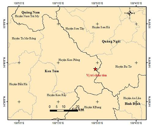
The epicenter of the earthquake occurred in Kon Tum.
In the context of the unusual earthquake in Kon Tum, Dr. Nguyen Xuan Anh, Director of the Institute of Geophysics, proposed 5 urgent solutions, including the review and assessment of the seismic resistance design for the geophysics. hydropower projects and important works in Kon Tum province.
Along with that, conducting research to evaluate in detail the structural model and the maximum possible earthquake magnitude of the fault systems in the area of Kon Plong district and surrounding areas. Immediately establish a network of local earthquake observation stations (including 5 stations) in the area of Kon Plong district and surrounding areas. Research on the causes of earthquake chain occurring in Kon Plong district and surrounding areas, conduct risk assessment and develop risk response scenarios for Kon Plong district and surrounding areas. . In addition, to step up the propaganda and earthquake response for people in the earthquake-affected areas.
According to Dr. Nguyen Xuan Anh, earthquakes occur more frequently in recent times and tend to increase in magnitude. Although so far no damage to houses and people has been recorded in the above area, but certainly the seismic vibrations caused by the earthquake have made a certain impact on the lives of people in the area.
At the meeting of the Steering Committee for Natural Disaster Prevention and Control on April 19, Mr. Tran Quang Hoai, General Director of the General Department of Natural Disaster Prevention and Control, requested localities to regularly propagate and guide people on prevention measures. , avoid, ensure the evacuation of all citizens in the danger zone to minimize damage in the event of an earthquake.
Hoai also suggested the National Steering Committee for Natural Disaster Prevention and Control to actively coordinate with the Institute of Geophysics to urgently find out the causes and risks of earthquakes, install warning signs in time, build and provide a set of response manuals to the people. In addition, it is necessary to properly assess the earthquake risk in the near future to make specific plans and response scenarios to ensure the safety of the people.