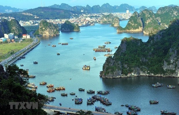
A corner of Ha Long Bay area, Quang Ninh province. (Source: VNA)
Ha Long Bay is taking advantage of the world natural heritage to promote tourism-based economic development, but these activities as well as the heritage values themselves are negatively impacted by the landslides on the island system.
Group of scientists Do Thi Yen Ngoc, Tran Diep Anh, Tran Tan Van, Doan The Anh, Nguyen Van Dong, Do Van Thang, Trinh Thi Thuy, Nguyen Phuc Dat of Institute of Geosciences and Mineral Resources (Ministry of Natural Resources and Environment) has implemented the project "Research and assess the current status of landslides and erosion of the island system as a basis for the management, conservation and proper exploitation of heritage values for development." to develop sustainably socio-economic in the areas of Ha Long Bay and Bai Tu Long. "
Scientists conduct landslide risk zoning in the Ha Long Bay area as an important scientific basis to help authorities at all levels develop disaster preparedness, adaptation and mitigation plans, as well as prepare measures to protect the islands here.
Objectively assessing geohazards
One of the "hot" issues of Ha Long Bay is the integrity of the heritage values, namely the integrity of the island system within the heritage area.
According to a report of Ha Long Bay Management Board, landslides have occurred recently, losing some, even all of the islands in the Bay, such as the 649 islands in 2013 and the Swan islands in 2016. ...
Cooperating with specialized consulting agencies, Ha Long Bay Management Board initially took some timely measures such as implementing a number of research tasks, assessing the current situation, finding out the causes and proposing Appropriate measures to mitigate and overcome consequences of geological disasters.
Based on the survey, the scientists have divided 5 levels of landslide risk.
Specifically, for the limestone islands in the Bac Son Formation, the risk of landslides is low and very low, accounting for 66.6% of the area, the average risk of landslides is 25.6% of the area and the risk of landslides is high and very high accounting for 7.9% of the area.
For Cat Ba rock islands, the risk of landslide which is low and very low accounting for 45.71% of the area, the average risk of landslide is 47.81% of the area and the risk of high and very high landslides is 6 , 47% of the area.
Island erosion in Ha Long Bay is a predominantly natural geological process / phenomenon that only becomes a catastrophe when it damages or threatens to damage people, facilities and the environment. .
But the erosion of islands in Ha Long Bay affects the integrity of heritage values, and thus is clearly a form of geohazards.
Zoning landslides areas
Through field surveys, scientists have determined a total of 456 points that are and are at risk of landslides, of which 288 points on the rocks of the Bac Son formation, 168 points on the Cat Ba formation rocks.
The scientists overlap the existing landslide maps on the established component maps, thereby analyzing and assessing the influence of each element, dividing them into appropriate levels to serve the establishment of a map of risk areas for landslides of islands.
Hierarchical map of sensitivity index integrated multivariate statistics (LSI) is divided into 5 levels of sensitivity for both limestone formations, corresponding to very low, low, medium average, high and very high risk levels.
Limestone islands in Bac Son formation are mainly at very low to low landslide risk (accounting for 2/3 of the area). The average risk of landslide accounts for a quarter of the area and the high and very high risk of landslide accounts for only about 8% of the area.
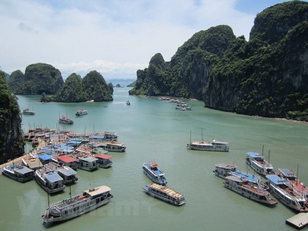
Ha Long Bay.
Similarly, for limestone islands in the Cat Ba Formation, the risk of landslides is low and very low accounting for about 45% of the area; the average risk of landslide occupies about 48% of the area; and the high and very high risk of landslide occupies about 7% of the area. From the results of the above-mentioned survey and research, a team of scientists from the Institute of Geosciences and Mineral Resources recommends that the areas with high and very high risk of landslides need to be inspected, supervised or being plugged warn and restrict people and vehicles passing, especially in rain season. It is necessary to apply a number of monitoring methods to areas where tourism activities are at the same time, there are high and very high risk of landslides, such as monitoring the rate of erosion of the island foot and the movement of the fissure system, monitoring landslide warning ...; continue to conduct detailed research on landslides for islands in the area of Ha Long Bay and Bai Tu Long. In particular, the islands are populated and are being invested to build large infrastructure such as roads, bridges, high buildings ... such as Cai Bau, Quan Lan, Co To, Thanh Lan. ... /.