MEKONG DELTA — High tides, dykes and land subsidence are causing serious flooding in urban areas in the Cửu Long (Mekong) Delta region, according to Nguyễn Hữu Thiện, an expert on the Delta's ecosystem.
Thiện told Thanh Niên (Young People) newspaper that excessive exploitation of groundwater had contributed to severe subsidence in the Delta.
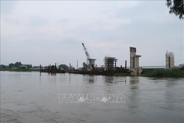
More than one million wells have been dug since the 1980s, and many dykes have been built along most of the Delta's rivers and canals.
“A huge amount of water cannot be discharged to fields or ponds. As a result, flooding occurs in urban areas,” Thiện said.
Research by Utrecht University in the Netherlands published in 2017 showed that the average land subsidence rate in the Mekong Delta is 1.1cm every 12 months. In some places, it has reached 2.5cm per year.
By 2050, the land subsidence rate is expected to reach 35-140cm per year, while the sea level could rise 10cm per year.
With the speed of subsidence higher than the pace of rising sea levels, severe flooding could occur.
Lê Anh Tuấn, deputy director of the Research Institute for Climate Change at Cần Thơ University, said the water level on the Hậu River in Cần Thơ City was 2.25m on September 30, higher than the peak tide of 2.23m recorded last year.
This is the highest level in the past few decades.
Only a number of new and upgraded streets are 2.3-2.5m high, a level that can prevent flooding. The height of old streets are from 1.6-2m, lower than flood levels, he said.
Most streets in the centre of Cần Thơ were covered with up to 0.5-0.6m of water.
Ngô Thị Thanh Trúc, a resident in Mậu Thân Street in the city’s Ninh Kiều District, said the floods had affected her businesses and family life.
“In recent years, I had to close my business due to serious floods,” she said.
On October 1, a 50-year old woman died after falling into Bún Xáng Lake in Cần Thơ City’s Ninh Kiều District.
The accident occurred at around 6.30pm while the woman was riding her motorbike on the road along the lake.
The women could not distinguish between the water in the lake and the floods, passersby said. People in the area tried to save her but it was too late because of the deep water.
Urban areas in An Giang, Vĩnh Long, Sóc Trăng and Hậu Giang provinces are also facing the same situation.
“Solutions are needed to mitigate the losses,” Tuấn said.
Hoàng Minh Tuyển from the Ministry of Natural Resources and Environment’s Department of Water Resource Management said the water flowing down from the upstream region had not caused flooding across the delta region. The water levels measured on the upstream of the dams were still low, he said.
On October 2, the water levels were 3.51m at Tha La Dam and 3.5m at Trà Sư Dam.
“Climate change and rising sea levels are the causes of the unusually high tides,” he said.
Tidal peaks are much higher than the average levels in previous years, often by 15-16cm.
Nguyễn Văn Thành, head of the Việt Nam Road Administration’s Road Management Department No.4, said there were 31 flood-prone sites on seven national highways. The department plans to upgrade these areas based on results of a survey of areas often hit by floods.
Priority will be given to a 1km-long section on National Highway 1A in Vĩnh Long Province’s Tam Bình District which was 50-60cm under water.
Improvement work on flooded areas in Hậu Giang, Sóc Trăng, Bạc Liêu and An Giang provinces will also occur next year.
In box
Releasing water from Trà Sư Dam
The Cửu Long (Mekong) Delta province of An Giang will release water from the flood-regulating Trà Sư Dam in An Giang Province’s Tịnh Biên District at 8am on October 4.
The flood-regulating Trà Sư Dam in An Giang Province will release water on October 4.
The release of water is usually done every year from the flood-regulating Tha La and Trà Sư dams to regulate flooding in the Long Xuyên Quadrangle region, which includes An Giang and Kiên Giang provinces and Cần Thơ City.
“It aims to remove the alum and bring alluvium to fertilise the soil in the region,” Lữ Cẩm Khường, deputy director of the provincial Department of Agriculture and Rural Development, said.
This year, the release is only being carried out at Trà Sư Dam because of the low level of floods and the two sewers being built to replace the dams. “It will not affect agricultural production in localities,” Khường said.