(Artwork: Hong Ninh / VNA)
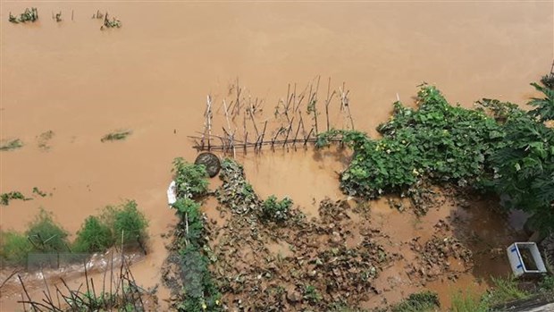
According to the National Center for Meteorological and Hydrological Forecasting, on the morning of August 13, the upstream water level of Thao and Lo rivers is slowly rising, other rivers in the North are changing slowly and at lower levels than alarmed by 1.5-3.5m. Due to the influence of the area of wind convergence up to 5,000m, the activity is gradually increasing, so the day and night of August 13, the North and Thanh Hoa have moderate to heavy rain, some places with very heavy rain with popular rainfall 40-80mm / 24 hours, some places over 120mm / 24 hours. The large-scale rain wave in the North of Vietnam is likely to last until August 18-19, the Northwest region and the North West region are likely to have heavy to very heavy rain.
On rivers and streams in the upstream area of Red-Thai Binh river, there is a possibility of a flood with flood amplitude upstream from 3-5m, downstream from 2-3m.
During this flood, the flood peaks on the upstream of Chay, Lo and Thao rivers are likely to be at alarm level 1 and above alarm 1, small rivers and streams reach alarm level 1- alarm 2.
There is a high risk of flash floods and landslides in many mountainous provinces in the North, especially in Lai Chau, Son La, Lao Cai, Yen Bai, Ha Giang, Tuyen Quang and Bac Kan. The risk of local inundation in low-lying and low-lying areas, urban areas, provinces of Lao Cai, Yen Bai, Ha Giang, Thai Nguyen, Lai Chau and Hanoi City.
According to Dr. Trinh Xuan Hoa, Deputy Director of the Institute of Geosciences and Minerals (Ministry of Natural Resources and Environment), in recent years, natural disasters such as landslides, landslides, flash floods occurred. especially in the provinces of Lao Cai, Son La, Yen Bai, Hoa Binh, Lai Chau, Hoa Binh, Thanh Hoa and a number of other localities, causing great loss of life and property of the people.
The cause of landslides and slips in Vietnam is mainly due to unusual weather phenomena, including prolonged heavy rains, and human activities such as deforestation, mining, and construction. construction of traffic works, houses ...
At the same time, the promotion of geological catastrophic processes, especially the phenomenon of landslides, landslides, floods, flash floods, develops strongly on a larger scale, the level of damage is increasing, threatening threaten community welfare. Besides, there are also a number of other reasons such as: areas with strongly dissected terrain, sloping terrain surface; thick weathered crust, quickly absorb water, easily saturated by rainwater, reducing slope stability; very little natural forests and protection forests, resulting in thin vegetation cover; Prolonged rain or local rain with great intensity during the rainy season. Currently forming a low-pressure trench with Northwest-Southeast axis in the East Sea region. Due to the influence of the low pressure trench combined with the southwest monsoon, the day and night of August 13, the Gulf of Tonkin, the waters from Quang Tri to Ca Mau, Ca Mau to Kien Giang, Gulf of Thailand, region between and the South East Sea, the waters of the Hoang Sa and Truong Sa archipelago with strong showers and thunderstorms; During a thunderstorm, there is a possibility of tornadoes and strong winds. All boats operating in the above waters are at high risk of being affected by gusts of wind and cyclones./.