Regarding the consecutive earthquakes that occurred in the past time in Kon Plong district, Kon Tum province, the Institute of Geophysics (Vietnam Academy of Science and Technology) has carried out a field survey and has initial report.
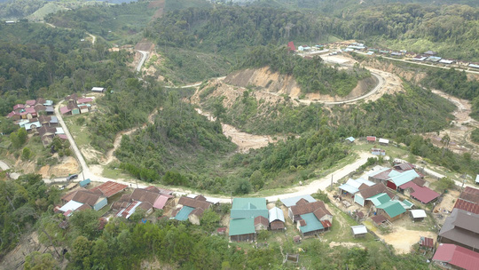
In a short time, a series of earthquakes occurred in Kon Plong district, Kon Tum province - Photo: HOANG THANH
Specifically, according to the report of the Institute of Geophysics on the morning of May 11, following the direction of Deputy Prime Minister Le Van Thanh, the Ministry of Science and Technology (Science and Technology), the Academy of Science and Technology, On April 19, 2022, the Technical Delegation (including experts and scientists) established by the Institute of Geophysics organized a field survey and assessment of earthquake activities in the area. area of Kon Plong district, Kon Tum province and surrounding areas (in which the earthquake investigation activity M = 4.5 happened on April 18). The technical team worked from April 19 to 29. The interdisciplinary delegation of the Ministry of Science and Technology and the Vietnam Academy of Science and Technology (including managers) worked from April 26 to 29.
According to the results of testing, surveying and assessing the effects of earthquakes, up to now, the Institute of Geophysics has concluded that earthquakes occurring from March 2021 to April 2022 have a magnitude of M. = 1.6 - 4.5 in the area of Kon Plong, Kon Tum districts and surrounding areas, causing the biggest tremors at grade V according to the MSK-64 scale. With such magnitude of concussion, it is not yet serious.
Initial assessment of the Institute of Geophysics, the earthquake in Kon Plong district, Kon Tum district is a provocative earthquake caused by the reservoir. However, in order to confirm the causes of earthquakes and have a basis to forecast the seismic activity trend and magnitude of earthquakes in the future in order to assess the possibility of damage to civil works and hydropower plants. , it is necessary to carry out detailed surveys, observations and studies on tectonic geology and seismic regimes in the area of Kon Tum province and surrounding areas.
According to the Institute of Geophysics, previous research results on the tectonic regime and earthquake activity in the Kon Tum area and the surrounding area are not detailed enough to be able to assess the cause and level of danger. of earthquakes for civil and hydroelectric projects. At the same time, there are no detailed studies of exciter earthquakes in the area. Therefore, a detailed study is needed to determine the cause and level of earthquake danger and propose appropriate response solutions, and at the same time, it is necessary to have close coordination of ministries/sectors and localities. localities and units managing and exploiting hydroelectricity in the area.
The Institute of Geophysics recommends: Working with stakeholders to quickly establish a network of local earthquake observation stations (expected to include 8 stations, of which 3 have been deployed since May-2021) in the area. Kon Plong district and surrounding areas, serving timely earthquake reporting.
Based on the field survey, implementing the direction of Deputy Prime Minister Le Van Thanh on earthquake handling in the area of Kon Plong district, Kon Tum province is proposed to the Ministry of Science and Technology as soon as possible. develop the task "Research and evaluate earthquake activity in Kon Tum province and surrounding areas for the prevention and mitigation of natural disasters caused by earthquakes" with the main contents of clarifying the causes of the chain. earthquake occurred in Kon Plong district and surrounding area; the relationship between earthquake activity and reservoir storage; forecasting earthquake activity trends; assess the danger and develop possible response scenarios for the area of Kon Plong district and surrounding areas.